

I live in Las Vegas, which means Utah’s Mighty 5 are basically in my backyard — and I’ve now done all five of them. Not in one trip, to be honest: I hit Zion, Arches, and Canyonlands in 2023 with my friend Jon (including Angel’s Landing, permits and all), and Amy and I did Bryce Canyon and Capitol Reef this year on a trip hosted by Ofland Escalante out of Escalante, Utah. Between the two trips, I’ve got the full loop dialed.
So here’s the 5-day Utah national parks road trip itinerary from Las Vegas I’d recommend — the order that makes the driving make sense, the hikes worth doing, and the early mornings worth setting the alarm for. If you’re starting from Vegas, this is the most efficient way to see all five parks without spending the whole trip staring through a windshield.
The 5-Day Utah Mighty 5 Itinerary at a Glance
| Day | Route | Parks | Drive time |
|---|---|---|---|
| 1 | Las Vegas → Zion National Park | Zion | ~3 hours |
| 2 | Zion → Bryce Canyon National Park | Zion (morning), Bryce (afternoon) | ~2 hours |
| 3 | Bryce → Capitol Reef National Park | Bryce (morning), Capitol Reef | ~2.5 hours via scenic UT-12 |
| 4 | Capitol Reef → Moab | Capitol Reef (morning), Arches, Canyonlands | ~2.5 hours |
| 5 | Moab → Las Vegas | Canyonlands (morning), Valley of Fire option | ~6.5 hours |
Total loop: roughly 1,100 miles. It’s a lot of driving, but the drives themselves are half the experience out here — this is southern Utah, where the road between parks looks like a movie set. Also, can you do this trip in reverse? Absolutely. Some folks want to get the farthest drive (Las Vegas to Moab) out of the way first and leave the short drive home (Zion to Vegas) for when they’re tired. Do whatever makes you happy!
Best Time to Visit Utah’s National Parks
The best time for this road trip is spring (April–May) or fall (September–October). Summer brings triple-digit heat in Zion and Arches, peak crowds, and timed-entry headaches; winter can close Bryce’s higher elevations with snow and ice.
Noah Ellis, the CEO of Ofland Escalante, put it well when we talked to him: May is beautiful, but late September might be the single best window — the days are still warm, the nights cool off, monsoon season has passed so everything’s green, and every hike is on the table. Coming from Las Vegas, where you’re already heat-acclimated, shoulder season is pure upside.
High season runs roughly Memorial Day through Labor Day. If that’s your only window, the trip still works — you just have to commit to the early start strategy (more on that below), because parking lots at Zion, Arches, and Canyonlands fill by mid-morning.
Day 1: Las Vegas to Zion National Park
Drive: ~160 miles, about 3 hours from the Las Vegas Strip to Springdale, the gateway town at Zion’s south entrance.
Get the early start. I’m serious about this one — the parking lot at the Zion Canyon Visitor Center fills up fast, and once it’s full you’re parking in Springdale and walking or shuttling in. Jon and I stayed at the La Quinta Inn & Suites in La Verkin — about 20 minutes from the south entrance — and timed it to be parked as the park opened. That early arrival is the whole game at Zion.
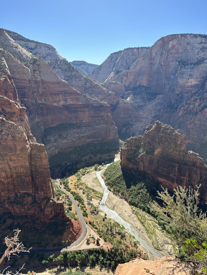
Here’s the thing first-timers need to know about Zion: for most of the year, private vehicles aren’t allowed on the Zion Canyon Scenic Drive. You park once and ride the free shuttle up the canyon, hopping off at trailheads. It sounds limiting; it’s actually great, because the canyon does the entertaining and you just look out the window.
What I’d do with one day in Zion:
- Morning: Ride the shuttle to the Temple of Sinawava and walk the Riverside Walk — an easy, paved 2-mile round trip along the Virgin River into the narrowing canyon. It’s the appetizer.
- Midday: Angel’s Landing, if you have a permit. Jon and I won ours in the seasonal lottery for our 2023 trip, and I’ll be straight with you: the chains section is genuinely exposed, and the permit system exists because the trail can’t handle unlimited traffic. Apply at recreation.gov well ahead of your trip. If you don’t draw a permit, the West Rim Trail to Scout Lookout gives you most of the views without the chains — same trailhead, no permit needed.
- Afternoon: The Emerald Pools trails or the Pa’rus Trail for something mellower. If it’s hot, the Narrows (wading up the Virgin River) is the classic cool-down — check conditions at the visitor center first, since flash flood risk is real.
Where to stay: We stayed at the La Quinta Inn & Suites in La Verkin — clean, easy, and a straight 20-minute shot to the south entrance in the morning. If you’d rather walk to the park, Springdale sits right outside the entrance with pricier lodge-style options.
Don’t miss on the way in: If you have an extra hour, the Kolob Canyons section of Zion sits right off I-15 north of St. George — a 5-mile scenic drive with huge red rock views and a fraction of the main canyon’s crowds. Easy detour on your way in or out.
Day 2: Zion to Bryce Canyon National Park
Drive: ~85 miles, about 1.5 to 2 hours from Springdale to Bryce Canyon City via UT-9 and US-89. Short driving day — that’s intentional, because Bryce deserves a full afternoon.
If there’s anything left on your Zion list, do it in the morning — one more shuttle ride up the canyon at sunrise is never a bad call — then point the car northeast. You’ll climb from ~4,000 feet at Zion to over 8,000 feet at Bryce, and you’ll feel the temperature drop. Pack a layer even in summer.
What I’d do with an afternoon and evening in Bryce:
- Navajo Loop Trail: This is the essential Bryce hike — down through the switchbacks past the famous hoodoo amphitheater, about 1.3 miles if you combine it with the Queen’s Garden trail into a loop. Go down the Navajo side, come up Queen’s Garden — easier on the knees.
- Sunset Point at sunset, Sunrise Point at sunrise. They’re named honestly. The light on the hoodoos at golden hour is the reason people make the drive.
- The 18-mile scenic drive along the park’s main road hits all the overlooks — Bryce Point, Inspiration Point, Natural Bridge, Rainbow Point at the end. You can do the whole thing in a couple of hours with stops.
- A UTV tour with ROAM Outdoor Adventure Company: Amy and I kicked off our 2026 trip with their “Grand to Bryce Overlook” tour out of Tropic, and I’d recommend it a thousand percent. You take back roads to a scenic overlook above Bryce Canyon — one set of vistas to the west, the outer edges of Bryce to the east — at about 65 miles an hour, occasionally tilted sideways enough to count ants. It’s the high-adrenaline counterpoint to a day of overlooks.
Bryce is the park people underestimate and remember most. The elevation keeps it cooler than Zion, the crowds thin out past the main amphitheater, and the night skies are stupidly good — it’s a certified Dark Sky park.
Where to stay: We were based at Ofland Escalante for this whole leg, but if you’re following the itinerary night by night, Bryce Canyon City or Tropic keeps you closest to the park entrance for an early start.
Day 3: Bryce to Capitol Reef National Park via Scenic Byway 12
Drive: ~120 miles, about 2.5 to 3 hours — and this is one of the great drives in America, so don’t rush it.
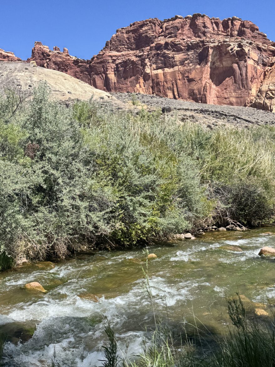
UT-12 or Scenic Byway 12 from Bryce to Capitol Reef is a designated All-American Road, and it earns it: you cross the Grand Staircase-Escalante National Monument, wind through the tiny town of Escalante, and crest the Hogback — a narrow ridge with drop-offs on both sides and no guardrails. Amy was in the passenger seat refusing to look down; on the way back I was driving and she returned the favor. Take it slow and use the overlooks — they’re every couple of miles because the road basically demands it. We were sweating through the Lower Calf Creek hike at midday and driving through snow in the mountains an hour later. That’s the Scenic Byway.
Worth a stop on the way:
- Lower Calf Creek Falls: About 125 feet of waterfall at the end of a 3-mile-one-way hike (not round trip, despite what you may have heard — we learned that the fun way). The trail is mostly soft sand, which makes it feel more strenuous than the elevation suggests, and there’s a $5 parking fee. But the falls sit in a rock amphitheater that’s easily 20 degrees cooler than the trail, and the payoff is enormous. The trail is dog-friendly — our lab mix Chief came along and appointed himself the trip’s morale officer.
- Kiva Coffee House: Built into a cliffside along the highway with a wall of windows overlooking the canyon — the letters blend into the rock so well we drove past it the first time. Amy and I went back twice, including a 35-minute drive from Escalante just for coffee and avocado toast on our last day. They also rent a cottage below the coffee house if you want to stay.
- Hole in the Rock Road: This long dirt road out of Escalante is lined with trailheads — including the Zebra slot canyon trailhead, though construction had the lot closed when we tried. If you have a high-clearance vehicle and half a day, this is where the locals go.
Lunch in Escalante: Pizza Outfitters comes personally recommended by Noah Ellis, the CEO of Ofland Escalante — and the man knows his town’s food scene.
Capitol Reef is the quiet one of the Mighty 5 — fewer crowds, no shuttle system, no timed entry — and Amy and I loved it for exactly that reason on our hosted trip with Ofland Escalante this year. The park centers on the Waterpocket Fold, a 100-mile wrinkle in the earth’s crust, and the historic Fruita district, a pioneer settlement with orchards you can pick from in season.
What I’d do with an afternoon in Capitol Reef:
- Scenic drive to the end of the paved road and back, with stops at the Grand Wash and Capitol Gorge turnoffs. The canyon walls close in and the light does wild things late in the day.
- Hickman Bridge Trail: a 1.8-mile round trip to a massive natural bridge — the best short hike in the park if you’re watching the clock.
- Fruita orchards: if fruit is in season (roughly June through October depending on the crop), you can pick and eat for free in the orchards and buy bags to take with you. Check with the visitor center on what’s ripe.
- Sunset at Panorama Point or Sunset Point. Capitol Reef’s west-facing cliffs catch the last light beautifully, and you’ll likely have the overlook mostly to yourself.
Where to stay: Ofland Escalante, in the town of Escalante right on Scenic Byway 12 between Bryce and Capitol Reef. Amy and I stayed here on our hosted 2026 trip and it’s the ideal base for this leg — a boutique outdoor hotel with cabins and Airstreams, private fire pits (with s’mores kits), a drive-in movie theater, a food truck, and a pool and hot tub for the end of the day. It’s aggressively dog-friendly — Chief was welcomed everywhere, including the camp store — and the dark skies are unreal; we watched a family of deer wander right past our cabin at dusk. Roughly an hour or so to Capitol Reef’s entrance, 35 minutes to Kiva Coffee House.
We spent a whole episode on this stretch — the UTV tour, Lower Calf Creek Falls, Kiva Coffee House, and my interview with Ofland Escalante CEO Noah Ellis:
Day 4: Capitol Reef to Arches and Canyonlands (Moab)
Drive: ~140 miles, about 2.5 to 3 hours from Torrey to Moab via UT-24 and I-70.
This is the big double-header day, and it works because Arches and Canyonlands share Moab as a base — the two parks are about 30 minutes apart. Get another early start: tour the Fruita area or squeeze in a short morning hike at Capitol Reef, then drive to Moab by midday.
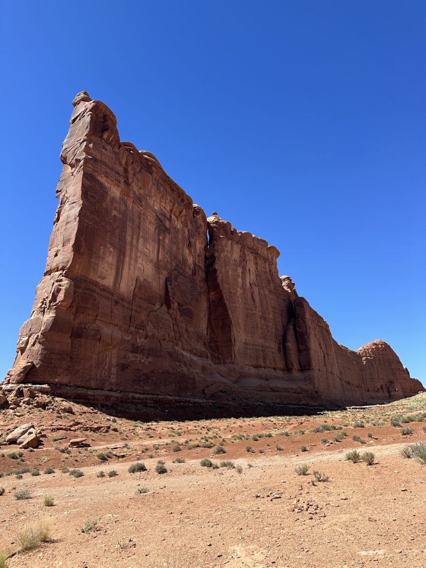
Arches National Park (afternoon): Arches runs a timed-entry reservation system during peak season (roughly April through October) — book your entry window at recreation.gov before the trip. I did Arches with Jon in 2023, and the non-negotiable stop is Delicate Arch. It’s a 3-mile round-trip hike with some slickrock scrambling and zero shade, so go late afternoon for the light and the slightly cooler air. The arch at sunset, with the La Sal Mountains behind it, is the single most iconic view in the Utah parks. If you’re short on time or energy, the Windows Section gives you a cluster of huge arches — Double Arch, the Windows — right off the main road with minimal walking.
Canyonlands, Island in the Sky district (sunset): From Arches’ entrance it’s about a 30-minute drive to Canyonlands’ Island in the Sky. Mesa Arch at sunrise or sunset is the photographer’s shot — the arch frames the canyon and the sun lights it from below at dawn. Grand View Point at the end of the scenic drive overlooks thousands of feet of canyon in every direction. I did the Island in the Sky with Jon, and the scale of it genuinely recalibrates your sense of distance — you keep thinking the far canyon wall is close, and it’s miles away.
Where to stay: Moab. Two nights here if you can swing an extra day (more on that below). It has a ton of options to choose from no matter what you’re looking for. Low budget inns, swanky ranch-style properties, condos, suites for longer stays. A quick Google search will give you plenty of options, but like everything else, peak season means slimmer options so the sooner you can set your plans, the better.
Day 5: Canyonlands Morning, Then Back to Las Vegas
Drive: ~460 miles, about 6.5 to 7 hours from Moab to Las Vegas. Long day — front-load the good stuff.
Morning: One more Canyonlands stop on your way out. If you caught sunset at Island in the Sky on Day 4, do sunrise at Mesa Arch on Day 5 — it’s a 10-minute drive from the turnoff and a half-mile walk, and dawn light through the arch is worth the alarm. Alternatively, Dead Horse Point State Park sits between Moab and the Island in the Sky entrance — the overlook above the Colorado River gooseneck is spectacular, it’s a state park so the national park pass doesn’t apply (small day-use fee), and it’s rarely crowded.
The drive home: I-70 west to I-15 south is the fast route. But if you have an extra two hours and any energy left, detour to the Valley of Fire State Park in Nevada — it’s about an hour northeast of Las Vegas off I-15, Nevada’s oldest state park, and the red Aztec sandstone looks like southern Utah snuck across the state line. The Mouse’s Tank Road drive and the Fire Wave trail (check seasonal closures — it closes in summer heat) are the highlights. It’s the perfect bookend: you started the trip leaving Vegas, you end it with one last desert landscape before the skyline comes back into view.
You’ll roll into Las Vegas by evening. Total loop: five parks, roughly 1,100 miles, one very good week.
Where to Stay: Night-by-Night
| Night | Town | Why |
|---|---|---|
| 1 | La Verkin | Our pick — 20 minutes to Zion’s south entrance, easy morning arrival |
| 2 | Bryce Canyon City / Tropic | Closest beds to Bryce’s entrance (we met our UTV tour in Tropic) |
| 3 | Escalante (Ofland Escalante) | Our pick — mid-route base for UT-12, Bryce, and Capitol Reef |
| 4 | Moab | Base for both Arches and Canyonlands |
Book early for spring and fall — the gateway towns are small and the good rooms go first. Each of these small areas has plenty of budget-friendly options or higher-end luxury properties. The sooner your plans are set in stone, the better off your wallet will be. Also, another reminder, peak season means less rooms are going to be available, so book as soon as you can.
Tips for the Drive
- Start early, every day. This came up in every park section because it’s the single biggest lever on the trip. Parking lots fill, trailheads crowd, and the light is better. The “early start” advice isn’t generic filler — at Zion and Arches in peak season, it’s the difference between hiking and circling a full lot.
- Buy the America the Beautiful pass. One annual pass covers entrance fees at all five national parks, and it pays for itself about two parks in. (It doesn’t cover state parks like Dead Horse Point or Valley of Fire — those charge small separate day-use fees.)
- Reserve timed entries ahead. Arches requires timed-entry reservations in peak season; Angel’s Landing at Zion requires a permit lottery. Both are booked at recreation.gov. Do this the week you book the trip, not the week before you leave.
- Carry more water than you think. Southern Utah is high desert. The Colorado River looks close on every map and it’s always farther than you think. A gallon per person per day in the car, plus filled bottles for every hike.
- Download offline maps. Cell service dies in the canyons — especially in Capitol Reef and the Needles. Download your Google Maps regions before you leave Vegas.
- Gas up in the towns. Stations are sparse between parks. Top off in Springdale, Bryce Canyon City, Torrey, and Moab.
If You Have an Extra Day
The report’s topic list keeps surfacing the same add-ons, and they’re all legitimate:
- Monument Valley (Navajo Nation, ~2.5 hours south of Moab): the Mittens and Merrick Butte are the most filmed landscape in the American West. It’s tribal land, not a national park — the 17-mile valley drive is the experience.
- Goblin Valley State Park (between Capitol Reef and Moab): a valley of hoodoo-like rock goblins you can wander freely through. Weird, fun, great with kids, easy detour off UT-24.
- Horseshoe Bend (near Page, Arizona): the Colorado River’s famous gooseneck, a short walk from the parking lot. Pairs naturally with Antelope Canyon and Lake Powell — we covered the whole Page area in Ep. 70 if you want the deep dive.
- The Needles district of Canyonlands: wilder and emptier than Island in the Sky, but it’s a real detour — save it for a second trip unless you have the extra day.
FAQ
Can you really do all 5 Utah national parks in 5 days?
Yes, but it’s brisk — one full day per park with driving between them. If you want to hike seriously (full-day trails, not overlooks), take 7 days. The 5-day version hits every park’s headline experience without feeling like a death march.
What’s the best month for this road trip?
April–May and September–October. You’ll dodge the worst heat, the worst crowds, and most of the timed-entry pressure. Winter is doable but Bryce sits above 8,000 feet — expect snow and icy trails.
Do I need reservations for the parks?
Arches requires timed-entry reservations during peak season; Zion’s Angel’s Landing requires a permit lottery year-round. The other parks don’t currently require entry reservations, but check nps.gov before you go — this changes.
Is the drive from Las Vegas to Zion scenic?
The I-15 stretch is fine, but the trip gets gorgeous the moment you turn onto UT-9 toward Springdale and unreal on Scenic Byway 12 between Bryce and Capitol Reef. The “scenic drive” topic topping the report’s list isn’t an accident — the roads are genuinely part of the experience.
Can I do this trip in reverse?
Absolutely — Vegas to Moab first (long day), then work back through Arches, Canyonlands, Capitol Reef, Bryce, and Zion. Some people prefer getting the longest drive out of the way on day one when energy is highest.
Keep exploring
- Ep. 163 — Utah’s Wild Corridor: Bryce, Escalante & Capitol Reef — the full episode on our Ofland Escalante trip, including the interview with CEO Noah Ellis.
- Click here for the complete Noah Ellis interview
- Ep. 70 — Page, Antelope Canyon & Lake Powell — the natural add-on if you extend toward Arizona
- Ep. 180 — Great Basin National Park — Nevada’s own national park, and an easy trip from Vegas in the other direction