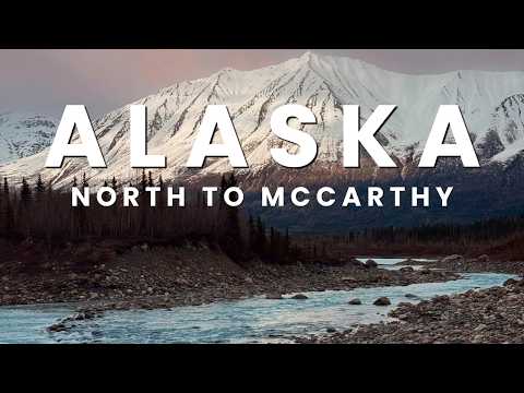
Sixty miles of gravel stand between the end of the pavement and one of the best-preserved mining towns in Alaska — and the shuttle schedule at the far end decides whether you actually see it. We learned that the hard way. Here’s how the road works, what we’d check before driving it, and the plan we’d run next time.
Quick favor: If you enjoy the show, follow the Unscaled Travel Show on Apple Podcasts or Spotify and leave us a rating — it’s the easiest way to help other travelers find us.
How This Trip Actually Happens
Kennecott was not on our itinerary when the day started. We left Cooper Landing that morning, drove back through Anchorage, and stopped at the Wrangell-St. Elias visitor center at Copper Center — which, worth knowing, sits outside the park boundary. We went in for a pin and a sticker. We came out studying a map, because the map is where Kennecott shows up: a copper mining town from the early 1900s, kept intact deep inside the park, at the far end of a road neither of us had heard of.
That discovery is the trap. Wrangell-St. Elias covers more than 13 million acres, and almost none of it is reachable by car — very few roads run in or out, by design since the park was set aside in 1980 under ANILCA. A place that looks like a short hop on a visitor center map is actually a half-day commitment: a paved drive down to Chitina, then 60 miles of gravel, then a footbridge, then a shuttle or a hike.
We made the run anyway, late in the day, with a hotel booked four hours north. Everything below is what that taught us.
The McCarthy Road: What 60 Miles of Gravel Is Really Like
The pavement gives out just past Chitina, and so do services. Getting from the visitor center to the parking lot where the road ends took us about two and a half hours in total; the gravel stretch by itself ran roughly two hours. Plan on that pace. This is not a road you make up time on.
What it is, though, is a good drive. Lakes sit right against the road with mountains behind them, and for long stretches there is nobody else on it. About halfway in you cross the Kuskulana Bridge — one lane of decking suspended, per the figures we cited on the show, more than 130 feet above the river and a little over 200 feet long. Traffic is light enough that stopping for photos is realistic; we did it in both directions.
The road ends at a parking lot. From there, McCarthy itself is reached on foot, across a footbridge — roughly a half mile of walking puts you in town. There are restrooms at the end of the road (basic ones; set expectations accordingly), and on the drive in you’ll pass a scattering of lodges and camps, so the area is not as empty as the road makes it feel.
Two warnings from our run:
- Respect the tire situation. We arrived to find another visitor disabled by a flat they couldn’t change, waiting for a truck to reach them. On this road, a spare you can’t install is the same as no spare. Check yours before Chitina, not after.
- Carry what you need. Fuel, water, and food should all be sorted before the pavement ends. There is no reliable place to fix a planning mistake on the gravel.
Should You Drive It? And What About a Rental?
Our answer is yes — with conditions, and the conditions are the whole point.
The warning signs posted near Chitina tell you plainly that you want a dependable vehicle for this road, and that it’s closed in winter. Believe the signs. You don’t need a specialized off-road rig — we drove it in an ordinary rental car — but you do need a car in good shape, a real spare, and enough daylight for the round trip without rushing.
On the rental question, since it’s the one everyone asks: we took our rental down the McCarthy Road, and we had taken the insurance. Read your agreement before you go, know exactly what you’ve signed, and make the call with your eyes open. And don’t treat the gravel as a shortcut: two hours each way is the honest number, and any plan built on beating it is built on luck.
Kennecott: The Town, the Shuttle, and the Mistake
Here is the fact that organizes everything: you cannot drive to Kennecott. The town sits about five miles beyond McCarthy. From the footbridge, your options are the shuttle or your own feet — roughly five miles each way, call it ten round trip.
Shuttle vans connect the two towns and pick up at stops around McCarthy. They are cheap, they are simple, and they stop running earlier than you think. We crossed the footbridge at 6:20 in the evening. The final shuttle of the day had departed about 30 minutes before we got there.
So we stood in McCarthy doing the arithmetic we should have done over breakfast. Ten miles of hiking, in the evening, after a full day of driving, with almost no food in the car — a couple of bags of mixed nuts, and water short too — and a four-hour drive to Delta Junction still ahead. Amy had pushed for this detour because she thought I’d love the place, and she felt awful about how it ended; she even offered to spend the night in the car so the two of us could take the morning’s first shuttle. I turned that down. Kennecott went back on the list for a future trip.
We can’t describe the mill buildings or the town itself, because we haven’t seen them yet — and we’re not going to dress up somebody else’s visit as ours. What we can tell you is what Kennecott is: in its day it was among the richest copper producers on the planet, and the town that supported the mines has been preserved rather than left to fall in. It is the entire reason the road exists as a trip. Give it the day it requires.
The rule we’d hand anyone copying this drive: build the day backward from the last shuttle. If you can’t be standing in McCarthy by mid-afternoon, don’t start the gravel — stay over instead (see below) and ride out in the morning.
Where to Sleep
This is where our plan failed a second time.
The right answer is to sleep near McCarthy. Lodges and camps operate along the road and around the town, and waking up there converts Kennecott from a gamble into a morning shuttle ride. McCarthy itself is tiny — the town’s website puts full-time residents at about 30 people — so book ahead.
What we did instead: we had a room waiting in Delta Junction, four hours north, and drove it through the night, arriving at the Alaska Frontier Inn around 2 AM. We remember almost nothing beyond falling into bed — although, for the record, it had the nicest bathroom of any stop on our trip. A four-hour night drive after a full day out is not a strategy. It’s what happens when the strategy fails.
The night before matters too: starting that morning from Cooper Landing is why our visitor center stop landed in the early afternoon and the whole schedule slid. Stage closer — Copper Center or Chitina way — and the day gets easier.
The Drive North: What the Miss Bought Us
Because we missed Kennecott, we ended up on the Richardson Highway a little after six that evening, facing four hours of driving in the weeks when the sun barely sets. We’d tell you to make this drive on purpose.
We stopped at Liberty Falls, a small state park pull-off right where we came off the McCarthy route, and photographed a bald eagle by the road. Then the highway emptied out — we passed maybe two other cars all night — and the wildlife started using it. Moose stood at the edge of the pavement. A herd of Dall sheep walked the shoulder. Just before 11:30, with the sky still light, Amy hit the brakes hard for a caribou stopped in the center of the highway, close enough that the joke afterward was about nearly collecting a reindeer.
By half past midnight the sun was down behind the mountains but the light hadn’t quit; it sat at dusk while we drove, exhausted and a little punchy, past frozen lakes still holding ice. We have argued about Alaska highways ever since, and the Richardson is the one we both put at the top, ahead of the famous Seward Highway. The Glenn Highway, which we’d driven that morning along the Matanuska River with the glacier in view, makes the same argument. Everybody talks about the Seward. These two earn a hearing.
One practical note: animals use this road after midnight, and the lingering light fools you into driving like it’s early evening. Slow down anyway.
If You Have Another Day: An Ice Cave and a Christmas Store
Two shorter lessons from the following day.
Castner Glacier’s ice cave sits off the Richardson Highway, roughly 45 minutes south of Delta Junction. Online, the approach reads as an easy walk of about a mile; locals on site put it closer to two. In May, none of that mattered, because the route was buried in soft snow. We dressed for it — snow pants, hiking boots — and sank anyway, first to our knees and then past our waists, and the far side of the creek offered the same treatment. We quit. Putting Amy at risk for a photograph is not a close decision. With snowshoes, or later in summer once the pack settles, locals describe it as an easy hike. In spring conditions, budget for the snow, not the distance — and know that Jeremy maintains a shoe may still be out there.
North Pole, about 20 minutes from Fairbanks, is worth an honest paragraph. The Santa Claus House is a big, year-round Christmas store — ornaments, souvenirs, and postcards that leave with a North Pole postmark; they’ll mail yours on the spot or hold them until just before Christmas. Santa wasn’t in; May is his off-season, apparently. The reindeer operation next door, Antler Academy, lets you watch from the gate at no charge outside the season; in season, tours take you inside the fence. Amy’s verdict: she arrived expecting a Christmas movie and found that beyond the Santa Claus House block, North Pole is largely an ordinary town, candy-cane-striped street lights notwithstanding. We both want to return in December and grade it when it’s trying.
When to Go
- Winter is out. The McCarthy Road closes for the season; this is a warm-months trip only.
- We went in May, early in the season, under the long light. The upside: empty roads and daylight that lets a blown schedule stay safe. The downside: services were still waking up, some things hadn’t opened, and snow still owned any trail that wasn’t plowed.
- Deep summer is when the end-of-road area has the most going on — more services and excursion options around McCarthy. If Kennecott is the goal rather than the drive, that’s your window.
- Whenever you go, the shuttle schedule is the fixed point. Seasons change the light and the crowds. They don’t change the arithmetic.
McCarthy & Kennecott FAQ
Q: Can you drive all the way to McCarthy? Yes — 60 miles of gravel separate Chitina from the parking lot where the road ends, about two hours on the gravel itself. From the lot, you cross a footbridge into town on foot.
Q: Can you drive to Kennecott? No. Past McCarthy, the choices narrow to two: the shuttle, or walking roughly five miles each way. There is no third option, and missing the last shuttle removes the first one.
Q: Can this be a day trip? It can, but only if the day is built around it: start early, protect the shuttle times, and don’t stack a long transfer on either end. We attached it to a Cooper Landing-to-Delta Junction day and missed Kennecott by half an hour. Sleeping near McCarthy the night before removes the risk.
Q: Is a rental car allowed on the McCarthy Road? We drove our rental on it, with the insurance taken. Read your own agreement first — the posted warnings at Chitina about having a dependable vehicle are more than a suggestion once conditions turn.
Q: When is the McCarthy Road open? Warm months only — it closes in winter. Even in season, services along it are few, so fuel, food, and water are your responsibility before Chitina.
Q: What is there to do if we miss the shuttle? Exactly what we did: walk McCarthy, take your photos at the Kuskulana Bridge on the way out, and drive the Richardson Highway north in the evening. A good consolation — but a consolation. Book the night in McCarthy next time. We intend to.